Lab-Aids: Plate Tectonics - Plate Boundary Computer Simulation Kit
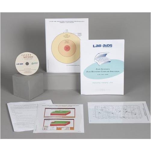
In this investigation student use actual data and a CD-ROM computer simulation designed at the Lawrence Hall of Science to investigate the geology of plate boundaries. In Part 1, students compare and contrast continents with continental plates, draw plate boundaries from earthquake and volcano data, and label the major plates with their names and arrows indicating the direction the plates are moving. In Part 2, students use a computer simulation to explore what happens at plate boundaries over time. In Part 2 they investigate the changes that occur along divergent (spreading), transform (sliding), and convergent (colliding) plate boundary over different time periods ranging from 10 years to 20 million years. They then compare the geologic features of the three different kinds of plate boundaries and the earth processes that cause them.‚ ACCESS TO COMPUTERS REQUIRED. Developed by SEPUP.
Scientific Concepts:
- The crust and the solid upper layer of the mantle are known as the lithosphere
- The movement of the earth's plates can produce earthquakes and volcanoes, and result in the formation of mountains over geological time
- The earth is over four billion years old, and different events have occurred on earth during different periods of time
- The continents are part of large lithospheric plates that have moved over geological time and continue to move at a rate of centimeters per year
- Creating models is one way to understand and communicate scientific information
Content List:
- 1 Teacher's Manual
- 32 Student Worksheets and Guides, Parts 1 and 2
- 1 Plate Motion Simulation CD, SEPUP
- 1 Transparency 1: Layers of the Earth
- 1 Transparency 2: Key to Plate Boundaries
- 1 Transparency 3: Plate Motion Simulation: Screen Shots
Classroom Planning:
- To complete this kit requires one to two ~50-minute class periods
- Number of Students: 32


