Lab-Aids: Using Remote Sensing to Determine Topography Kit
Students are introduced to remote sensing through a hands-on activity that allows them to collect data about concealed landforms then use it to create visualizations of the landforms. Each student group collects data that allows them to construct a line graph showing a profile across the landform. Then the class data is combined so that students have enough data to create a false-color topographical map of the surface of the landform. This remote sensing measuring technique is related to applications in earth science, oceanography, and space science as students compare their false color map to a topographic map. Developed by SEPUP.
Scientific Concepts:
- Technology, such as remote sensing, is essential to science because it provides instruments that enable observations of objects and phenomena that are otherwise unobservable
- Scientists organize and summarize data using tables and maps
- Science and technology are reciprocal and are often inspired by societal challenges and priorities
- Scientists test their explanations of nature using observations and models
Content List:
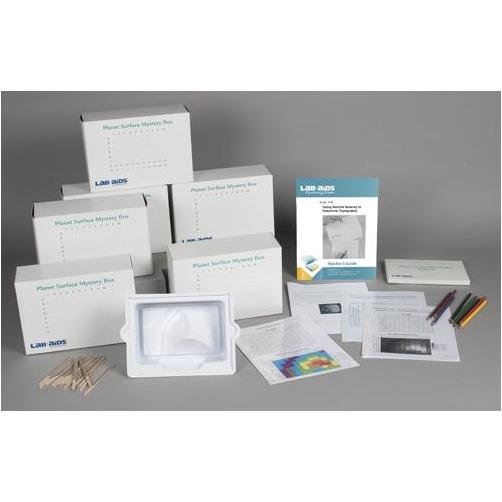
- 1 Teacher's Guide
- 28 Student Worksheet and Guides
- 12 Measuring Probes, LAB-AIDS®
- 6 Remote Sensing Devices, LAB-AIDS®
- 1 Landforms Models, LAB-AIDS®
- 1 Mystery Box, LAB-AIDS®
- 1 Platform Box, LAB-AIDS®
- 6 Colored pencils: red, yellow, orange, green, blue, purple, and brown, Sets of 7
- 1 Transparency 1: Height of Surface Measurements of Planet Surface
- 1 Transparency 2: False-Color Topographic Map of the Planet Surface
Classroom Planning:
- To complete this kit requires one to two ~50-minute class periods
- Number of Students: 24


